BlackBird V2
Hyperspectral Camera Drone
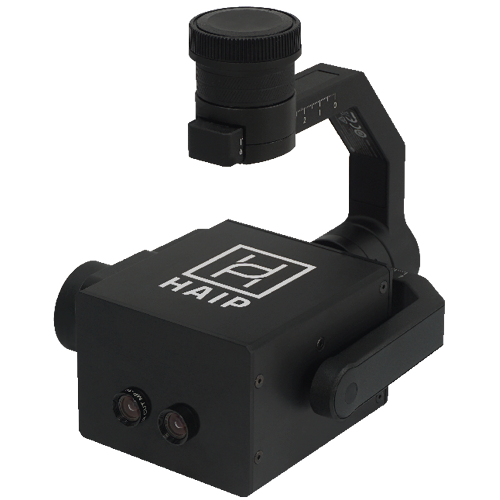
The BlackBird V2 is the easiest way to take images with a hyperspectral sensor on drones.
Hyperspectral camera drone
Ready to fly
The BlackBird V2 camera was especially designed for easy integration with DJI drones from M300, 350 and 400 RTK series.
Via the Skyport V2 interface all connections are established with a twist of your hand.
Full gimbal control
BlackBird V2 is based on a hyperspectral linescanner, but there is no need to move the sensor during image acquisition to get a full hyperspectral data cube. With this feature you can also move to an off-nadir position and take images.
Easy to use
Thanks to the RGB sensor of the hyperspectral camera, a livestream can be displayed on the remote control during the flight. With this feature you get two images (RGB & HSI) at the same time with similar spatial dimensions.
Intelligent Imaging
Additional pre-processing on camera is possible, as the camera has a build-in GPU (NVIDIA Jetson). Overview images for the evaluation of correct exposure settings are processed automatically. Images are saved on an external USB-A stick.
Specifications
Built for UAV hyperspectral imaging
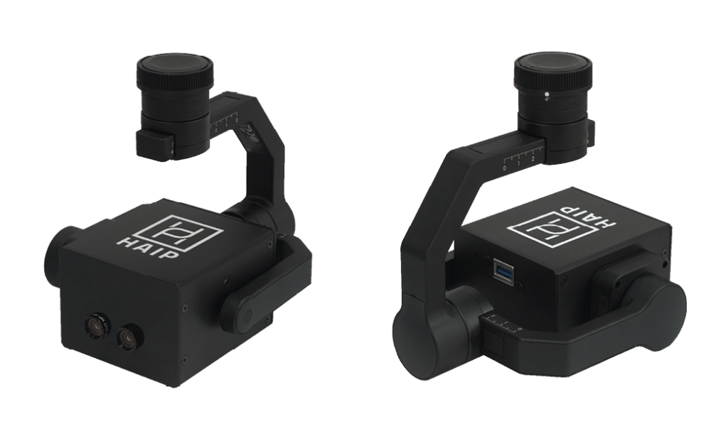
TWO SEPARATE SENSORS
High quality RGB-livestream + RGB & HSI images simultaneously
VNIR (500 - 1000 NM)
100 spectral bands, high signal-to-noise ratio in NIR range
SMART HYPERSPECTRAL LINE-SCANNER
Two modes: Hover & Line-Scan; NVIDIA Jetson GPU integrated
DJI SKYPORT V2 INTERFACE
Ready to fly within seconds, connection just with a twist of your hand
DATA STORAGE ON 256 GB USB-A STICK
Plug the stick directly into your computer's USB-A port for data transfer
Spectral Range
500 – 1000 nm
Scanning method
Linescan and single shot
Sensor Type
CMOS
Spatial Resolution (RGB)
3840 x 2160 px
Connection
DJI Skyport 2.0 connector
Spatial Resolution (HSI)
540 x 540 px
Spectral Bands
up to 100
Internal data processing
NVIDIA Jetson Nano
Weight (inkl. Gimbal)
790 g
Size
80 x 60 x 90 mm
- Get all technical specifications.
Applications
UAV hyperspectral imaging

The BlackBird V2 enables non-destructive spectral monitoring of crops and vegetation across larger field areas.
Its VNIR hyperspectral sensor captures differences related to plant vitality, chlorophyll, canopy structure and stress responses, while the integrated RGB sensor provides corresponding high-resolution colour images. This supports applications such as plant phenotyping, vegetation-index calculation, growth monitoring and the early assessment of biotic or abiotic stress. Integration with DJI Matrice 300, 350 and 400 RTK drones enables repeatable aerial data acquisition throughout the growing season.
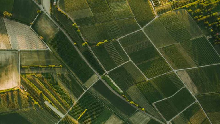
The BlackBird V2 enables spectral and visual monitoring of habitats, vegetation, soils and water-related environments across large or inaccessible areas. Repeated UAV surveys can establish baseline data and document changes in vegetation vitality, land cover and restoration progress over time. The simultaneous acquisition of hyperspectral and RGB images supports both spectral analysis and the creation of complementary orthomosaics and digital elevation models within one flight campaign. This makes the system suitable for ecosystem assessment, conservation projects, habitat restoration and long-term environmental monitoring.
- For more information view our application notes.
Sample data
BlackBird V2 is based on a VNIR linescanner, but there is no sensor movement needed during image acquisition to get a full HSI data cube. Unsure if spectral imaging solves your application? Get in touch with us and send your sample to HAIP Solutions for a measurement in our lab.
- You have specific questions? Feel free to contact our support.
Implemented technology

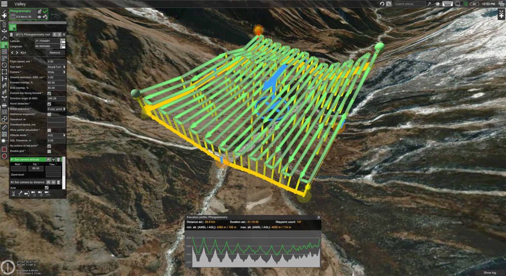
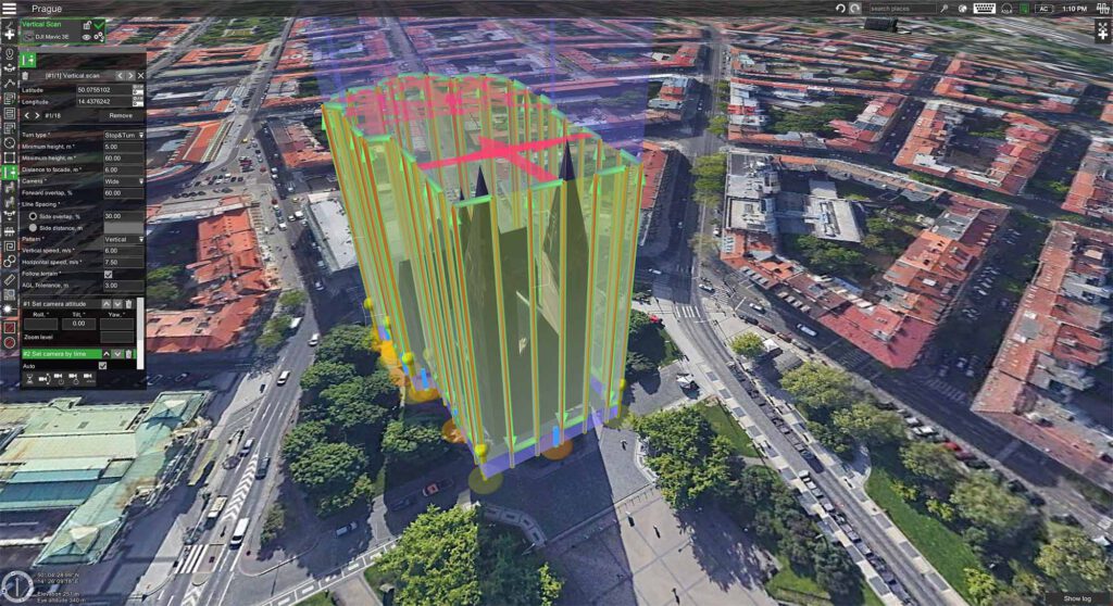
HAIP Solutions is now an official partner of UgCS, the leading professional drone flight planning software by SPH Engineering. With this new partnership, we bring precision mission planning to hyperspectral drone operations, helping you capture reliable, high-quality data more easily than ever before. With UgCS, BlackBird V2 users benefit from automated, terrain-following flight missions, optimized flight paths for hyperspectral imaging and full control over altitude, speed and sensor requirements.
HAIP Solutions, as an official reseller of UgCS, now offers these powerful features alongside our BlackBird V2 system. Together, they ensure consistent, repeatable results for applications in agriculture, environmental monitoring and research.
Integrated 4K RGB Camera
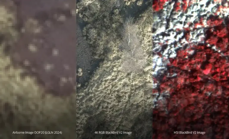
The additionally integrated RGB sensor in the BlackBird V2 camera acquires 4K RGB images simultaneously with the HSI images. This function is ideal for creating orthomosaics, digital elevation models and much more without the need for additional resources.
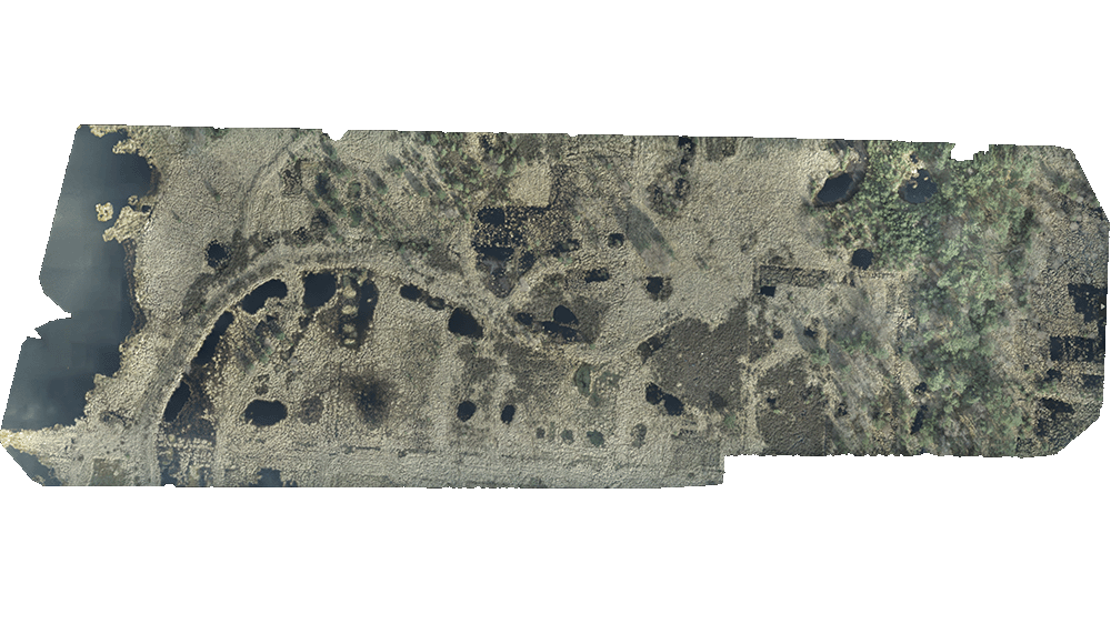
Orthomosaic for successful environmental monitoring
– Peatland site 6 ha, acquired 30 m above ground level
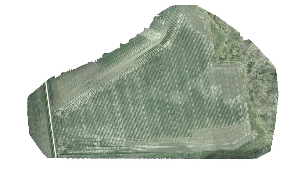
Orthomosaic for precise agricultural analyses
– Agricultural field 14 ha, acquired 70 m above ground level
HSI Remote Sensing
The collaboration between ReSe Applications LLC and HAIP Solutions has resulted in advances in hyperspectral remote sensing. The BlackBird V2 camera, combined with the PARGE® and DROACOR® software applications, enables high-precision positioning of hyperspectral images and accurate atmospheric correction. The HAIP BlackBird V2 camera also acquires high-resolution RGB images for orthomosaic and digital elevation model generation. Multiple critical datasets can be efficiently produced in a single flight campaign.
On-Site customer training
BlackBird V2 in Action
Our customer University Göttingen works with the BlackBird V2 camera drone. In this video you get insights of a full on-site customer training we provide for our customers.
Sie sehen gerade einen Platzhalterinhalt von YouTube. Um auf den eigentlichen Inhalt zuzugreifen, klicken Sie auf die Schaltfläche unten. Bitte beachten Sie, dass dabei Daten an Drittanbieter weitergegeben werden.
Mehr Informationen